Content Search

This node (Landing page > Content search) configures the search of the Landing Page: the search sources and the container project in which web maps and services found are opened.
Search sources
Under List of search sources, ArcGIS Online is always preconfigured. Add own portals (Portal for ArcGIS or ArcGIS Enterprise) as further search source with a name and the URL of the portal (e.g. https://gis.example.com/portal/). The user can search a single search source or all search sources.
The search is anonymous, so only publicly shared content is found. Only the item types that WebOffice 10.9 R5 can open are searched, with up to 20 hits per search source. Which types these are and how they are opened is described in the chapter Search of the Landing Page.
Container project
The property Container project (in older versions ArcGIS Online Container) defines the name or the URL of the WebOffice 10.9 R5 project that serves as container project for web maps and services found (Map Service, Feature Service, Image Service, WMS). Examples:
•worldwide (the project name only)
•https://gis.example.com/WebOffice/synserver?project=worldwide&client=core
•https://gis.example.com/WebOffice/externalcall.jsp?project=worldwide&client=core
If the project does not exist, the search behaves as without container project, and WebOffice 10.9 R5 writes a warning to the log file. The project name is case-sensitive.
•Without a container project, the search lists apps only (Web Mapping Applications, Dashboards, Web Experiences, StoryMaps). Web maps and services are not shown.
•With a container project, a selected web map or service opens the container project in a new window and adds the content. Technically, this is done with the start parameters service_url and service_type (see WebOffice URL call interface).
Requirements for the container project
•Client: The container project must open in the WebOffice core or in the WebOffice html client. WebOffice flex and WebOffice mobile do not add the selected content; in this case WebOffice 10.9 R5 writes a warning to the log file. If a different client is set as default for the project, the client can be specified in the URL of the container project (e.g. client=corejs).
•Tools: For web maps and ArcGIS services, the project needs the tool Add ArcGIS Service, for WMS the tool Add WMS.
•Coordinate system: Web Mercator (EPSG:3857) is recommended, as most ArcGIS Online content (basemaps, tile layers) uses this coordinate system. In a project with a different coordinate system, dynamic map services as well as feature and image services are reprojected by the server. Pure tile services without dynamic export (e.g. hosted tile layers, ArcGIS Online basemaps) and WMS services that do not offer the coordinate system of the project are not displayed.
•Allowed servers: If the tools restrict the servers for entered services (property Allowed servers for entered services), the servers of the services from the search must be on this list. The services of a web map are exempt when the web map is opened.
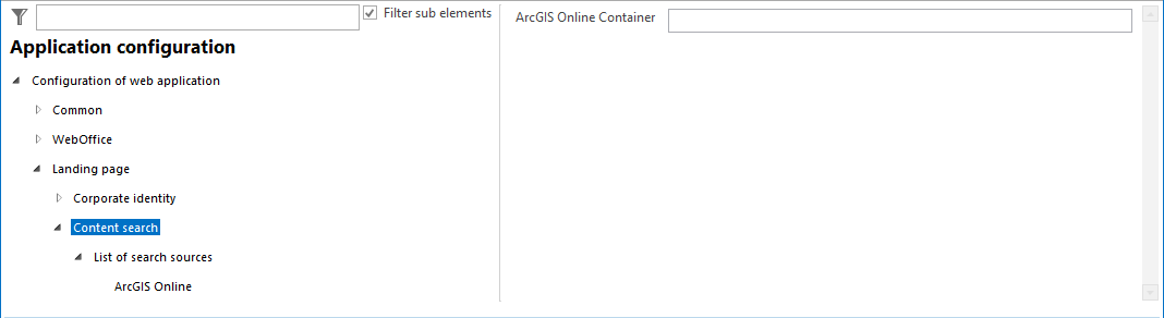
Configuration - Content search for landing page
|
The application must be reloaded after saving the changes for the Landing Page. |
