Handling |
  
|
Handling |
|
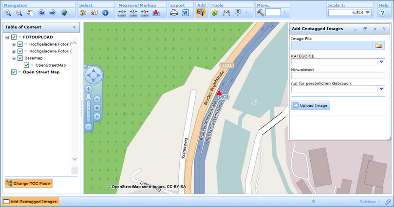
With a successful configuration the user can access the new tool Upload Geotagged Images in the toolbar of the WebOffice html client.
Upload Geotagged Images tool in the toolbar

Tool dialog
Browse to the image or ZIP file containing multiple images to be uploaded. Other available editing fields are provided by the administrator and only have to be filled if they are marked as mandatory. Start the uploading process by clicking the button Upload Image.
Note: Only images of type .jpg are supported.
After the images have been uploaded successfully the map gets updated automatically: