Identify Layer |
  
|
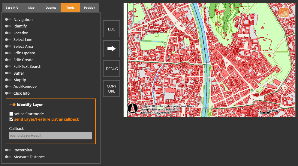
Identify Layer |
|
With this tool it is possible to identify distinctive object accurately. In contrast to the tool Maptip, not only the top layer object will be identified, but all objects from all layers that can be found on the click point:
Input parameter |
Description |
set as startmode |
By activating this parameter the tool will be initially activated after refresh of the WebOffice map widget. |
send Layer/FeatureList as callback |
By activating this parameter all the information about found layers and objects will be transmitted in the callback. |
Input parameters - Identify Layer in the WebOffice map widget Testcontainer
WebOffice map widget Testcontainer - Tool Identify Layer
Regarding the communication of information the following rules apply:
•If more than one layer is found on the click point, a list of layers is returned to the user. Additionally, the user will see immediately how many objects each layer contains at the click point. All found layers will be listed in the callback if the parameter send Layer/Feature List as callback is activated. After clicking one of the respective layers, the user either get a further list of objects or directly the MapTip depending whether a layer contains one or more objects at the click point.

Identify Layer tool - List of all layers
•If more than one object of a layer is found at the click point, the user will get a list of objects. All found objects will be also listed in the callback, in case the parameter send Layer/Feature List as callback is activated. After selecting an object, all the information regarding the object is returned in the MapTip.

Identify Layer tool - List of found layers
•If only one layer with one object is found on the click point, the MapTip is returned directly.
Note: Since WebOffice 10.3 SP2 WebOffice map widget supports alias names of layers and result fields in the MapTip tool.
Note: Since WebOffice 10.4 SP1 WebOffice map widget supports closing the MapTip result.
Note: Please be aware that the size and length of the MapTip is adjusted to the information content such as the number of search result fields.
Note: Detailed information about the configuration of the MapTip tool in WebOffice author can be found in chapter Identify MapTip.