Configuration |
  
|
Configuration |
|
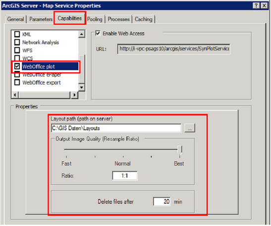
To use WebOffice plot in a WebOffice project, the map service for WebOffice plot has to be configured. By default the plot map service is the SynPlotService. For the configuration, following steps are necessary:
•Build up an admin connection to the ArcGIS Server in ArcCatalog.
•Stop the SynPlotService and open the Service Properties.
•Under the Capabilities tab, the installed WebOffice extensions are listed.
•Activate the WebOffice plot extension by checking the small box.
•Configure the layout path directory where the plot layouts are stored.
•Define the desired output image quality.
•Define the time when the files created during the plot request should be deleted from the output directory folder (e.g. arcgisoutput). By default, the value is set to 20 minutes. Please consider that the files are deleted after the next plot request.