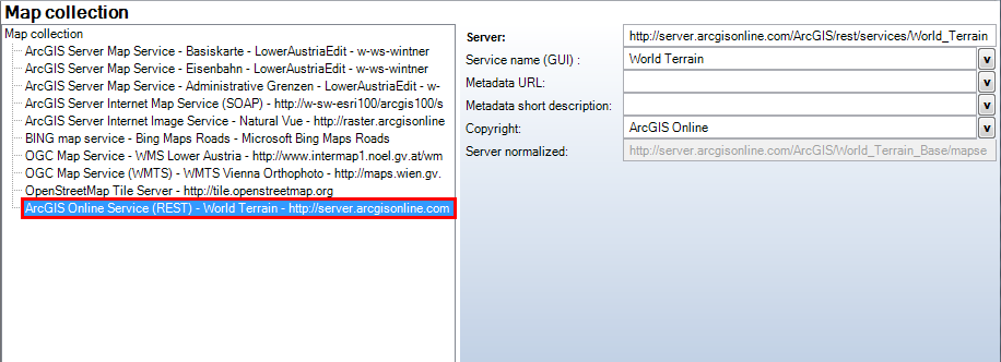
ArcGIS Online Service (REST) |
  
|
ArcGIS Online Service (REST) |
|
With ArcGIS Online service (REST), AGS Online services can be embedded into the project.
Note: Full product support available for services with version 10.1.
Property |
Description |
Server |
Server URL of the ArcGIS Online service Example: http://tiles.arcgis.com/tiles/Ok7pjj1ssdfsdfEneC7/arcgis/rest/services/DemonstationMap/MapServer |
Service name (GUI) |
Service name of Map Service displayed in the GUI |
Metadata URL |
Configure a reference to a metadata document (must be available via HTTP) as URL. You may configure the unique Metadata document identifier (UUID) of a Catalog Service (CSW 2.0) here. For this you must configure the SOAP interface of the Catalog Services using "Metadata display". |
Metadata short description |
Allows a short description of the medadata. Word wrap can be accomplished with a "\n". |
Copyright |
Service specific copyright text to be added to the configured project copyright if the map service contributes to the map. This information is only displayed on the print/plot. Note: The service specific copyright will only be displayed if the map element Copyright is configured. Note: Detailed information about the use of this attributes can be found in chapters Print Format and WebOffice ePaper template. |
Server normalized |
Normalized server URL |
Note: The indication of the MapServer Endpoint URL has to be provided. The indication of the FeatureServer Endpoint URL is not necessary because it will be identified automatically. The operation Query has to be allowed on the feature service.
If the service is protected, the user has to log-in on the client in advance. With the button "Continue Without Esri ArcGIS Online Login" the project can be used without the ArcGIS Online services.

Login for 2 protected ArcGIS Online services