ArcGIS Server Vector Tile Service

Since WebOffice 10.9 R5 it is possible to integrate Vector Tile Services into the clients WebOffice core and WebOffice flex and into the map widget. In contrast to cached Map Services Vector Tile Services are not based on raster technology, but on vectors. Therefore they are calculated faster and need less disk space.
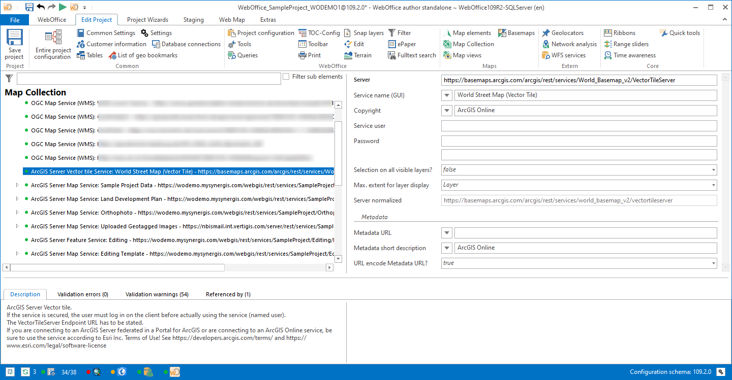
ArcGIS Vector Tile Service
You can either use your own Vector Tile Services or the ESRI Vector Basemaps in WebOffice 10.9 R5.
|
You will find an introduction for publishing Vector Tile Services in ArcGIS online help. |

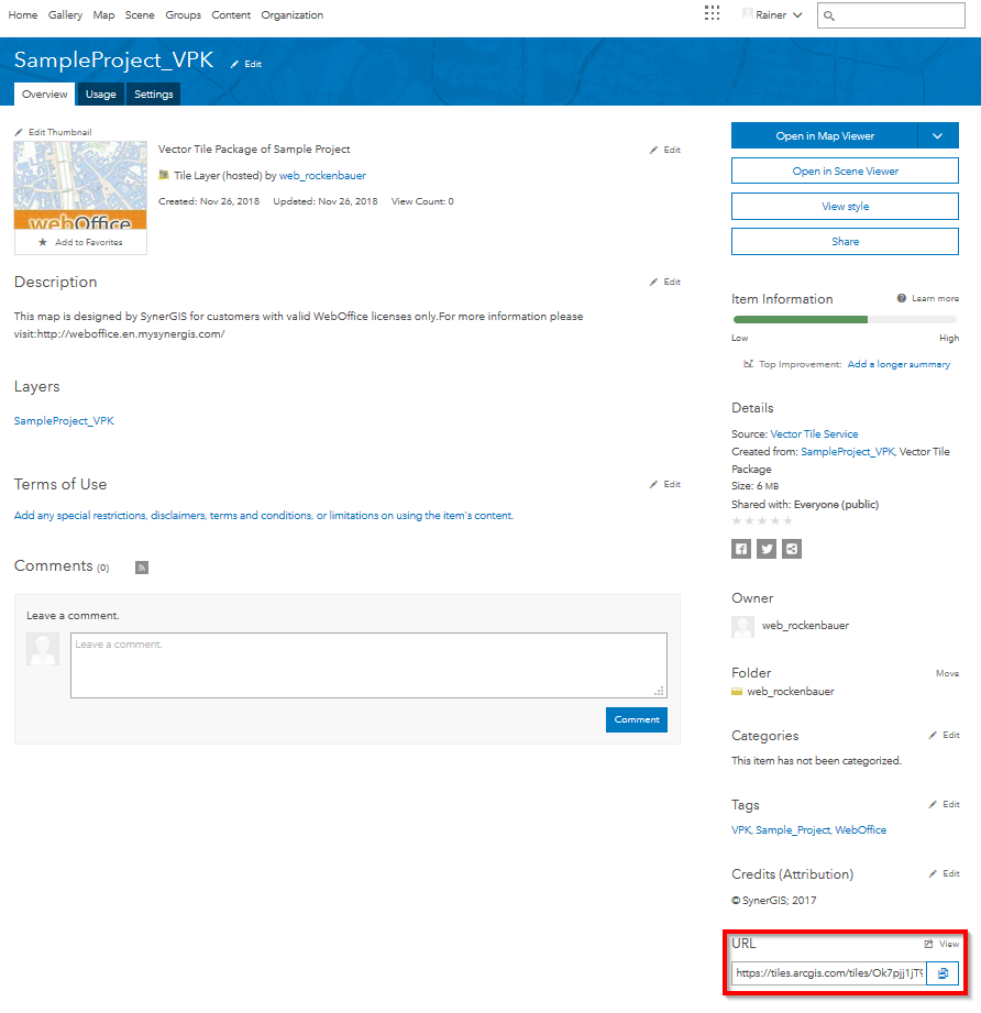
First of all open the distinct Vector Tile Service and copy the URL (see Screenshot below).
|
The ESRI Vector Basemaps (e.g. World Street Map, World Topographic Map, Light Gray Canvas) are no vector tile services of their own but styles on the service World_Basemap_v2. Enter the URL of the vector tile service as server and hand over the desired style with the property Style URL. |

Usage of the URL for WebOffice
Property |
Description |
||||
|---|---|---|---|---|---|
Server
|
ArcGIS Server vector tile service. If the service is secured, the user must log on to the client before using the service (named user). The Vector Tile Server Endpoint URL must be specified.
|
||||
Service name (GUI) |
Service name of Map Service displayed in the GUI |
||||
Metadata URL |
Configure a reference to a meta data document (must be available via HTTP) as URL.
|
||||
Metadata short description |
Provide a short description for the meta data (line breaks with \n). |
||||
Copyright |
Service related copyright information that is displayed on the client and on the print.
|
||||
URL of a custom style definition (root.json) for the vector tile service. Without this setting the default style of the service is used (…/VectorTileServer/resources/styles/root.json). An absolute http(s) URL is allowed, e.g. the style resource of a portal item (https://www.arcgis.com/sharing/rest/content/items/[item id]/resources/styles/root.json), or a path relative to the service URL. Credentials or tokens must not be part of the URL, an invalid URL is ignored with a warning in the log.
The style applies to the clients WebOffice core and WebOffice flex, to the map widget and to printing with VertiGIS Printing. |
|||||
Service user |
User login for accessing the ArcGIS Online service (ArcGIS service user). |
||||
Password |
Password of user accessing ArcGIS Online service. |
||||
Selection on all visible layers? |
When using the option All visible Layers in the Client all Layers visible in the current scale and set to visible are taken into consideration. A Layer configuration is not required, the ArcMap Layer Properties get used instead (Layer Name, visible Fields, Field order). |
||||
Max. extent for layer display |
With query layers, the map area cannot be defined manually because it is always calculated automatically. Furthermore, the map area can also change dynamically by capturing additional features afterwards. By selecting the value Service or Project it can be guaranteed that in WebOffice also newly captured objects are displayed outside the previous display area. |
||||
Server normalized |
Normalized server URL |