Graphicobjects export / import (GeoJSON)

With the Graphicobjects export / import (GeoJSON) tool, objects drawn in WebOffice 10.9 R5 (areas, lines, circles, texts, points) can be exported in .json format.
Export allows to continue working with the drawn data in other applications.
By importing, exported data from WebOffice or from other applications can be displayed in the client.
To provide the tool in WebOffice 10.9 R5, the Graphicobjects export / import (GeoJSON) node must be configured in the WebOffice author standalone.
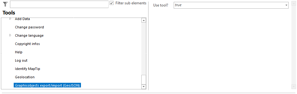
Tool Graphicobjects export (GeoJSON)
The only parameter Use tool? controls whether the tool should be provided in the client or not.
|
With WebOffice usermanagement enabled, the tool may need to be synchronized into the WebOffice usermanagement database and added to the appropriate application role if no default profile is used for the application role. Otherwise, the tool will not be visible in the client. |

|
ATTENTION! If the WebOffice project is not available in the coordinate system WGS1984 or Webmercator, the appropriate transformation code has to be added to the SynOutputService to ensure a correct export. For more details about the configuration at SynOutputService see Support Printing with Various Coordinate Systems. |

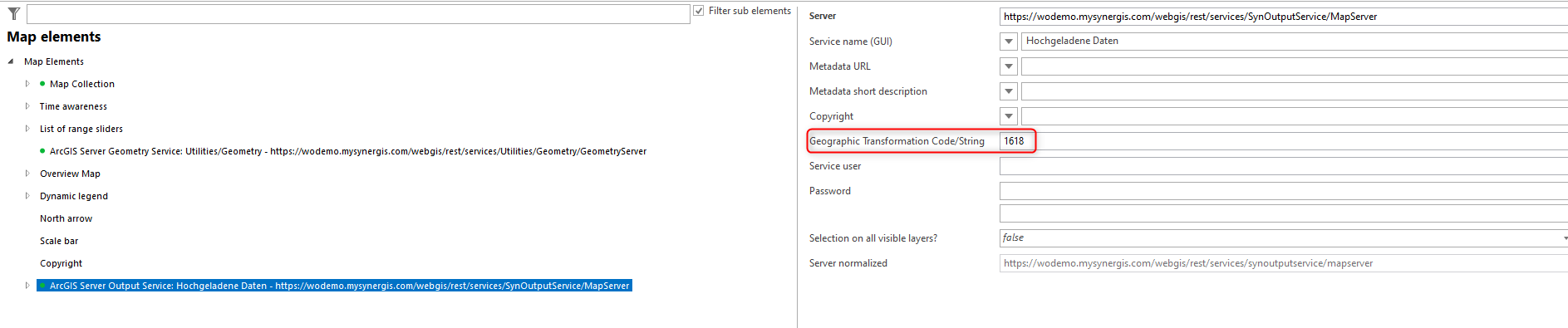
Transformation code at the SynOutputService
In the client, checkboxes can be used to select which types of objects should be exported. The list of possible objects depends on the tools configured in the project. The following are affected:
Rotation of texts
As of WebOffice 10.9 R6, the rotation of texts drawn with the Markup tool is kept when exporting and importing. It is stored in the attribute rotation: angle in degrees clockwise, 0 = horizontal (values from 0 to 360). If the attribute is missing or does not contain a valid number, the text is imported without rotation.
Other applications can use the attribute to rotate labels, e.g. QGIS (rotation from field rotation) or ArcGIS Pro (rotation type Arithmetic with the expression 360 - rotation).