BEV Cadastre

This custom tool shows the daily updated data of the Austrian cadastre of the Federal Office of Metrology and Surveying (BEV) in the map. A click on a parcel shows the province, political municipality, cadastral municipality, parcel number, legal status, deposit number, last change and the land uses with area and yield measurement ratio. The boundary points of the parcel are listed with number, type and marking. The parcel and its boundary points are highlighted in the map.
A click on a control point symbol opens the details of the control point with metadata, marks, coordinates and point sketches. While the tool is active, the parcel boundaries with the parcel numbers are shown up to a scale of 1:25,000 and the boundary and control points of the map extent up to a scale of 1:5,000, and the parcel under the mouse pointer is outlined. Under Show in map users switch parcel boundaries, boundary points and control points on or off individually. The browser remembers the choice. If the control points are hidden, a click always selects the parcel.
|
The data comes from the free cadastre service kataster.bev.gv.at of the BEV (open data, licence CC BY 4.0). The tool shows the source in its form. |

|
The tool is available in WebOffice core and WebOffice flex. It works in projects in Web Mercator, WGS 84 and in the Austrian coordinate systems (MGI Gauss-Krüger, Lambert, UTM). The coordinates are converted in the browser, no geometry service is needed for this. |

|
The tool loads all data directly from the BEV and does not need a map service in the project. The browser of the users must be able to reach https://data.bev.gv.at and https://kataster.bev.gv.at. The tool shows the parcel boundaries itself, from the WMS https://data.bev.gv.at/geoserver/BEVdataKAT/wms with the layer DKM_GST. If the boundaries should also be visible while the tool is closed, configure this WMS as a map service as well. |
|
The print contains the map services of the project and the users' drawing objects, but not the graphics of the tool. For the parcel boundaries to appear in the print, configure the WMS DKM_GST as a map service in the project. The print server must be able to reach https://data.bev.gv.at. In WebOffice core the button Add To Print adds the selected parcel with its boundary points and label, or the selected control point, to the print as drawing objects. The button is only shown if the Markup tool is available for the user in the project. The added objects can be edited or deleted there. The boundary and control points of the map extent are not printed. |
To be able to use this function, configure the custom tool tool_form.htm from the directory C:\Tomcat\webapps\<WebOffice application>\pub\custom_tools\BEVKatasterAT, which is delivered by default with WebOffice 10.9 R5, as follows:
(1) Web Integration - Custom Tool
Configure a custom tool from the Web integration group with the following parameters:
Parameter |
Settings |
|---|---|
URL of external page |
pub/custom_tools/BEVKatasterAT/tool_form.htm |
JavaScript function |
callFromWO |
Tool icon |
pub/custom_tools/BEVKatasterAT/tool_icon.png |
Tool icon (flex) |
pub/custom_tools/BEVKatasterAT/tool_icon_flex.png |
Visible in Client? |
Desktop and Flex |
|
WebOffice flex only shows the Tool icon (flex). Without this entry the tool has no symbol there. |
(2) Simple Custom Tool
Then, configure a Simple Custom Tool and set the parameter Tool mode to Click point.
|
If a content security policy is set up in the application configuration (see Content Security Directives), add https://data.bev.gv.at https://kataster.bev.gv.at to the directive connect-src and data: https://data.bev.gv.at to the directive img-src (for the point sketches and the images of the parcel boundaries). |
Further settings such as the scale limits of the point display or the highlight colours are made in the admin part at the beginning of the file tool_form.htm. The file readme.txt in the same directory describes them. As updates overwrite the delivered example files, copy the directory under a name of your own before you make changes.
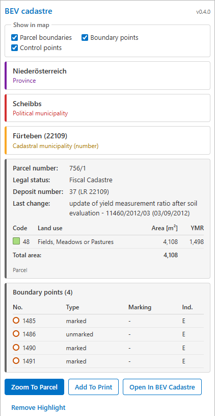
Information on a parcel with its boundary points
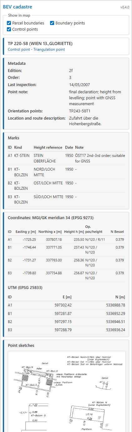
Detail view of a control point
|
For more details on configuring a custom tool, refer to the chapter Web Integration - Custom Tool. |