Mapillary |
  
|
Mapillary |
|
This custom tool allows the end user to open the Mapillary © widget in the WebOffice core client, which displays 360° views from the street perspective. To do this, configure the Custom Tool Mapillary.htm from the C:\Tomcat\webapps\<WebOffice application>\pub\custom_tools directory as follows:
Note: WebOffice 10.7 SP1 offers the technical possibilities to integrate Mapillary © into the application, but the license terms (terms of use) for using the Mapillary © service must be fulfilled in order to use the tool legally. If this is not the case, there is a license failure. VertiGIS does not assume any responsibility for the use of Mapillary © on the basis of licensing regulations. More information about Mapillary © can be found at the following link: https://www.mapillary.com/commercialterms.
(1) Web-Integration - custom tool
Configure a custom tool from the Web Integration tool group with the following parameters:
Url of the external page: pub/custom_tools/Mapillary.htm
JavaScript function: callFromWO
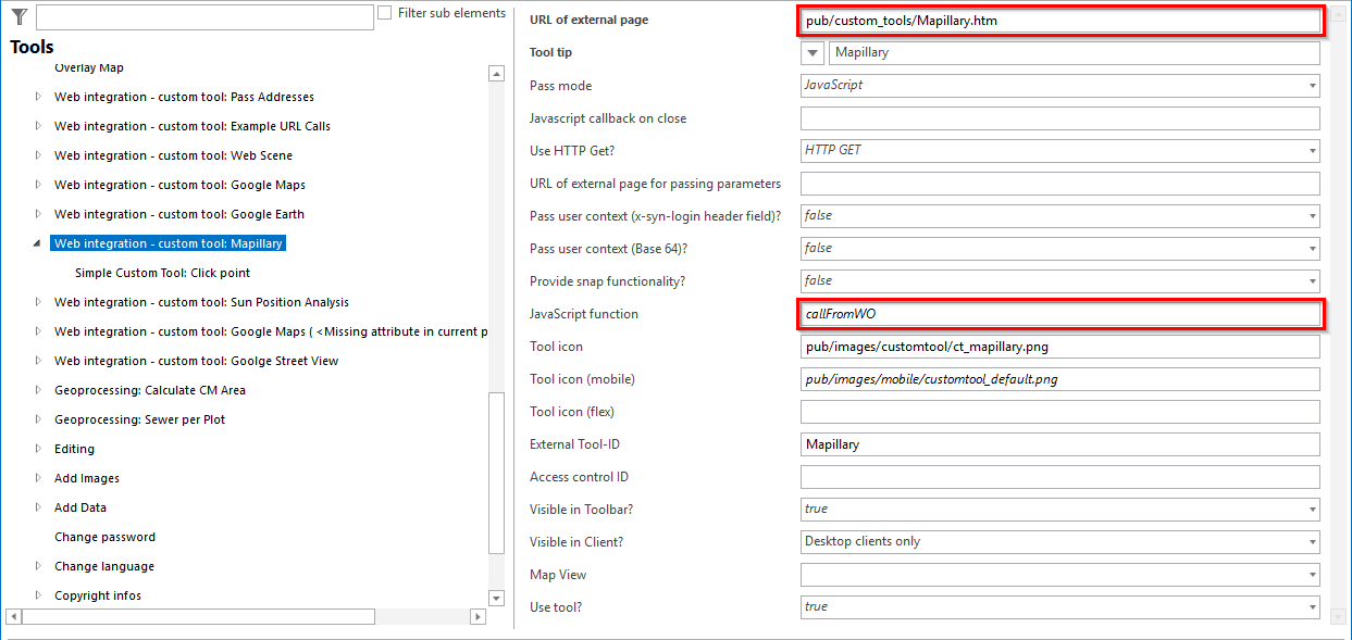
Configuration of the custom tool Mapillary
(2) Simple Custom Tool
Configure a Simple Custom Tool for the custom tool.
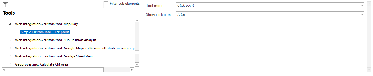
Configuration of a Simple Custom Tool for Mapillary.
Note: Under the following link you will find an ESRI Story Map with examples of Mapillary: https://mapillary.maps.arcgis.com/apps/MapSeries/index.html?appid=00305131ae3a412b9ec2c89656a0cf09
Note: For more details on configuring a generic tool, see the chapter Web-Integration - Custom Tool .
Note: The main map service of the project must be available in the Web Mercator Auxiliary Sphere WGS 1984 projection.
Note: As of WebOffice 10.7 SP1, the option "Coverage Layer" is offered. The position of the underlying Mapillary© images is displayed here. This function is only supported in WebOffice clients that are based on the ArcGIS API for JavaScript (e.g. WebOffice flex Client).