Function fields |
  
|
Function fields |
|
Function fields are fields that are automatically filled with data. The fields provide the textual content dynamically to the print output. WebOffice plot author offers a great variety of function fields.
These function fields are in accordance with the available predefined function fields in WebAuthor. The functions fields can be inserted in the layout template and get configured and filled by the WebAuthor. The assignation of the right function fields is done by the ID of the field value.
For every function field from the WebOffice plot author menu, two user fields are inserted:
-a field for the caption
-a field for the value
Following function fields are available:
Function Field |
Caption |
Value |
|---|---|---|
Creation date |
createdat_caption |
createdat_value |
Creator |
creator_caption |
creator_value |
Organisation |
orgname_caption |
orgname_value |
Title |
title_caption |
title_value |
Address |
orgadr_caption |
orgadr_value |
Disclaimer |
disclaimer_caption |
disclaimer_value |
Scale |
scale_caption |
scale_value |
Overview scale |
scale_caption_ov |
scale_value_ov |
Current map view |
syn_mapview_caption |
syn_mapview |
Page number |
syn_index_caption |
syn_index |
Copyright |
syn_copyright_caption |
syn_copyright |
Forename |
user_given_name_caption |
user_given_name_value |
Surname |
user_sur_name_caption |
user_sur_name_value |
Phone |
phone_caption |
phone_value |
Cellphone |
mobilephone_caption |
mobilephone_value |
Fax |
fax_caption |
fax_value |
email_caption |
email_value |
|
Company |
user_company_caption |
user_company_value |
Division |
user_division_caption |
user_division_value |
Department |
user_department_caption |
user_department_value |
Country |
user_country_caption |
user_country_value |
Street |
user_street_address_caption |
user_street_address_value |
Zip code |
user_zipcode_caption |
user_zipcode_value |
City |
user_city_caption |
user_city_value |
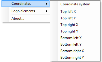
In addition, it is possible to insert coordinates and the coordinate system as function fields. The function field coordinate system automatically reads out the coordinate system which is used in the dataframe of the project. For the coordinates function fields, there exist no value and caption field, because the coordinates cannot be influenced or changed by the user. The following coordinate function fields are available:
Function Field |
Caption |
Value |
|---|---|---|
Coordinate system |
syn_crs_caption |
syn_crs |
For the logo, there are a number of predefined logo elements, for instance for the company logo or northarrow and scale. The logo elements have a predefined size. The following predefined logo elements are available:
![]()
Function Field |
Content (technical identification) |
Size |
|---|---|---|
North arrow |
northarrow |
1,2 x 1,2 |
Logo (company) |
company_logo |
6 x 3 |
Logo community) |
community_logo |
6 x 3 |
Coordinate markers |
syn_coord_marker |
1,8 x 2,4 |
Scale bar |
syn_scalebar |
2 x 27 |
Scale bar (without scale number) |
syn_scalebar_nms |
2 x 27 |
Scale bar (Web Mercator (Auxiliary Sphere)) |
syn_scalebar_web |
2 x 27 |
Scale bar (Web Mercator (Auxiliary Sphere)) |
syn_client_scalebar |
6 x 3 |