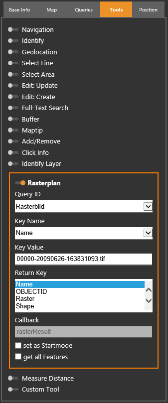
Rasterplan

Using this tool, an image of a raster catalogue can be displayed in the MapWidget.
Note: To use this tool, it is neccessary that a raster choice query is configured in WebOffice author. For further information, see chapter Raster Choice.
Raster choice tool in map widget
Input parameter |
Description |
Query |
Layer on which the query is performed. |
Key Name |
Identifies the attribute to be queried on. Note: The key name is the technical field name (not the alias name) and must be configured as Search Field. |
Key Value |
Value of the parameter, on which the query is based on. |
Return Key |
Attribute, which is displayed when requesting the tool. |
Callback |
The callback functions in the Callback.js are reserved for the WebOffice map widget testcontainer. Please ensure to use different notations for your own callback functions in order to avoid complications when calling the JavaScript functions. |
Set as Startmode |
By checking this parameter the tool will initially be activated after refreshing the map widget. |
Get all Features |
All features of the query layer are included in the query. |
Input parameters - Rasterplan at WebOffice map widget Testcontainer
When the tool is requested, it can be chosen which image shall be displayed.
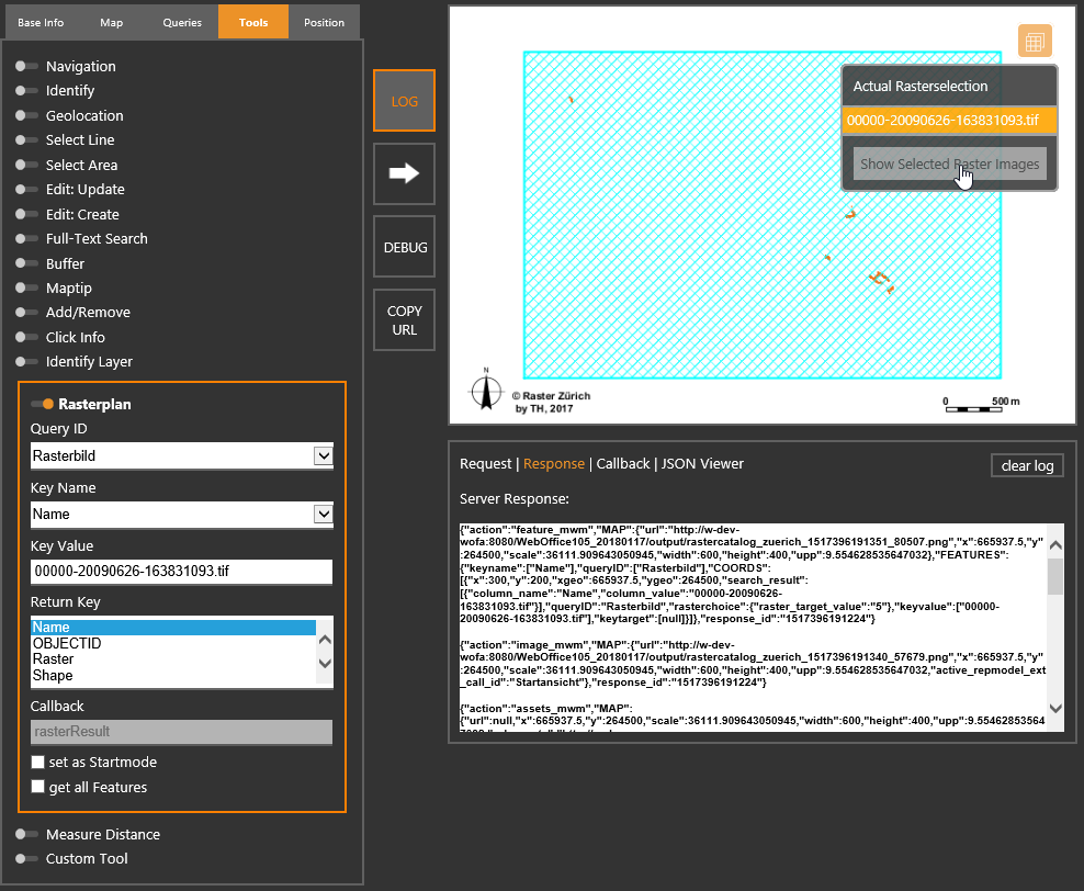
Request of the tool

Result of the tool